
angola vinyl sticker maps
angola vinyl sticker maps

angola framed maps
magnetic map angola. Magnetic Wall Maps from Netmaps are useful planning and tracking tools. Use magnetic markers and symbols to track customers, delivery points, service centers and much more.
Our magnetic maps are also laminated write on / wipe off and framed. We also sell colored magnets that you can have color coded to match your map needs.
All our Wall Maps are available as Magnetic Wall Maps. Worldwide delivery.
angola presentation map. Our map is part of our Netmaps’ Collection of PowerPoint Maps and Map outlines that you can use in your presentations.
Download editable maps for PowerPoint presentations with customizable maps that helps you prepare awesome presentations with sales by country or territory. Our editable PowerPoint maps are perfect for sales, marketing and supply chain presentations. We have country maps, continent maps and also World maps.
All PowerPoint slides are available in Microsoft’s .ppt format. This means that you should use MIcrosoft PowerPoint or OpenOffice. You can change the colours and lines to create interesting effects and designs. All slides come with a standardized colour scheme, effect and background design. If you wish to use your company’s corporate design, simply copy the slides into an existing company presentation and apply the design to the slide. That way slides could adopt your corporate design.
Creating thematic maps for Business or Marketing such as territory maps or sales maps is simply because all countries and maps are individual selectable shapes. Netmaps gives you the opportunity to create effortless dynamic custom maps for your presentations. They are professionally designed, perfectly optimized for business presentation requirements and ready to customize.

wall map angola. Size: 92 cm (smaller side). Laminated write on / wipe off. All maps are writable with Velleda Markers and encapsulated. Worldwide delivery for free. Included in price
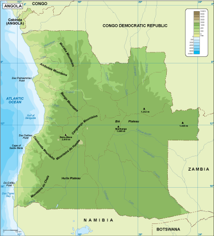
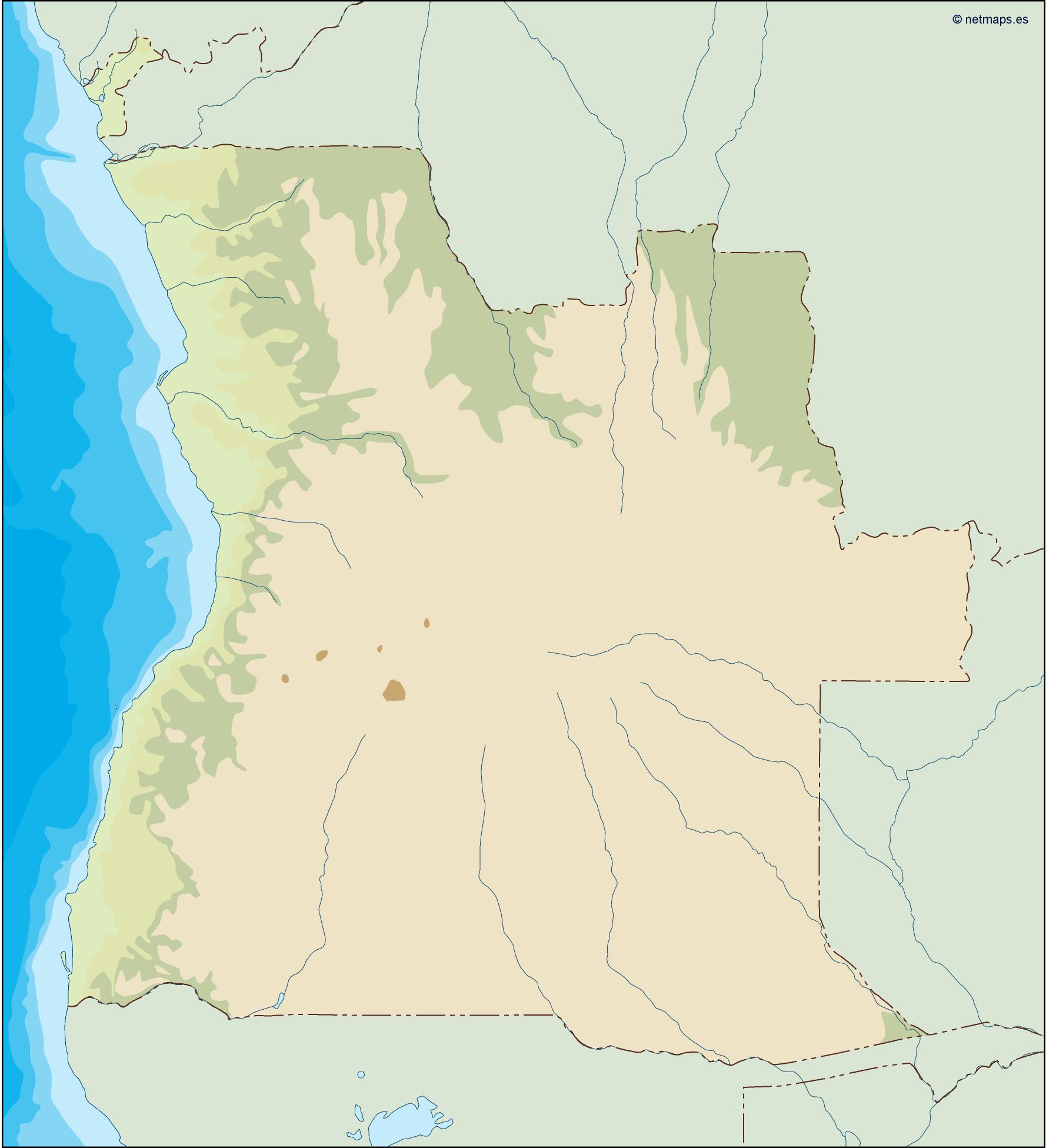
Angola physical map. Digital Maps Online. Adobe Illustrator .AI EPS Vector files from our Netmaps database.
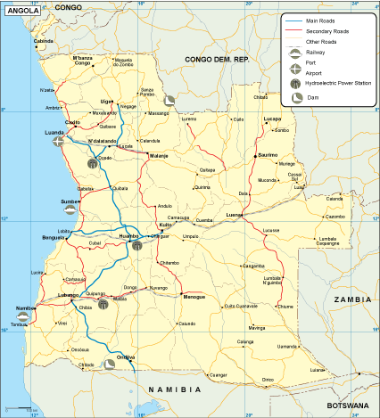
Angola transportation map. Digital Maps Online. Adobe Illustrator .AI EPS Vector files from our Netmaps database.
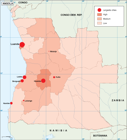
Angola population map. Digital Maps Online. Adobe Illustrator .AI EPS Vector files from our Netmaps database.
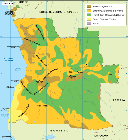
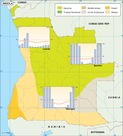
Angola vegetation map. Digital Maps Online. Adobe Illustrator .AI EPS Vector files from our Netmaps database.
Our series of Africa Vegetation maps is created as a map collection that meets the highest quality requirements of graphics professionals, and the flexibility to easily modify the appearance of the map to meet a wide variety of design specifications for any project – print, web, multi-media, and broadcast.
You can modify our vector EPS vegetation maps via Adobe Illustrator
– All Features are in Layers that you can turn on or off. Map features are saved in layers. Every layer can be manipulated independently.
– All Areas are complete objects you can select and modify. Every geographic area is a separate object you can select and edit. This makes it easy to highlight specific areas with color or fill patterns.
– All Lines are fully editable. Every line on a map (eg road, boundary, river) can be edited. You can change color, line width, line style.
– All Text is fully editable font text. Text is font-based, so it’s easy to change the font size and style. You can use your own choice of fonts. You can also add text with your own messaging.
– Our Vegetation maps Series are part of the Vector database from our company of cartographers ©Netmaps
Angola EPS map. Digital Maps Online. Adobe Illustrator .AI EPS Vector files from our Netmaps database. Vector maps from Africa. Illustrator EPS files, fully editable from our African map database. All our digital cartography was created with Vector Adobe Illustrator
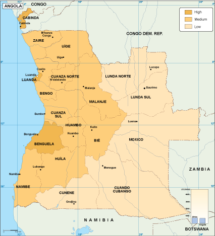
Angola economic map. Economic map. Our vector eps illustrator map. Our vector map has the three basic symbol types for vector data as points, lines and polygons (areas).
Our team of cartographers use these symbols to represent real-world features in maps, they often have to decide based on the level of detail in the map. In a economic map our map illustrates various economic phenomena and activities in a countryDigital Maps Online. Adobe Illustrator .AI EPS Vector files from our Netmaps database.
Angola climate map. Digital Maps Online. Adobe Illustrator .AI EPS Vector files from our Netmaps database. Digital Maps Online. Adobe Illustrator .AI EPS Vector files from our Netmaps database.
angola illustrator map. Digital Maps Online. Adobe Illustrator .AI EPS Vector files from our Netmaps database. Vector maps from Africa. Illustrator EPS files, fully editable from our African map database. All our digital cartography was created with Vector Adobe Illustrator
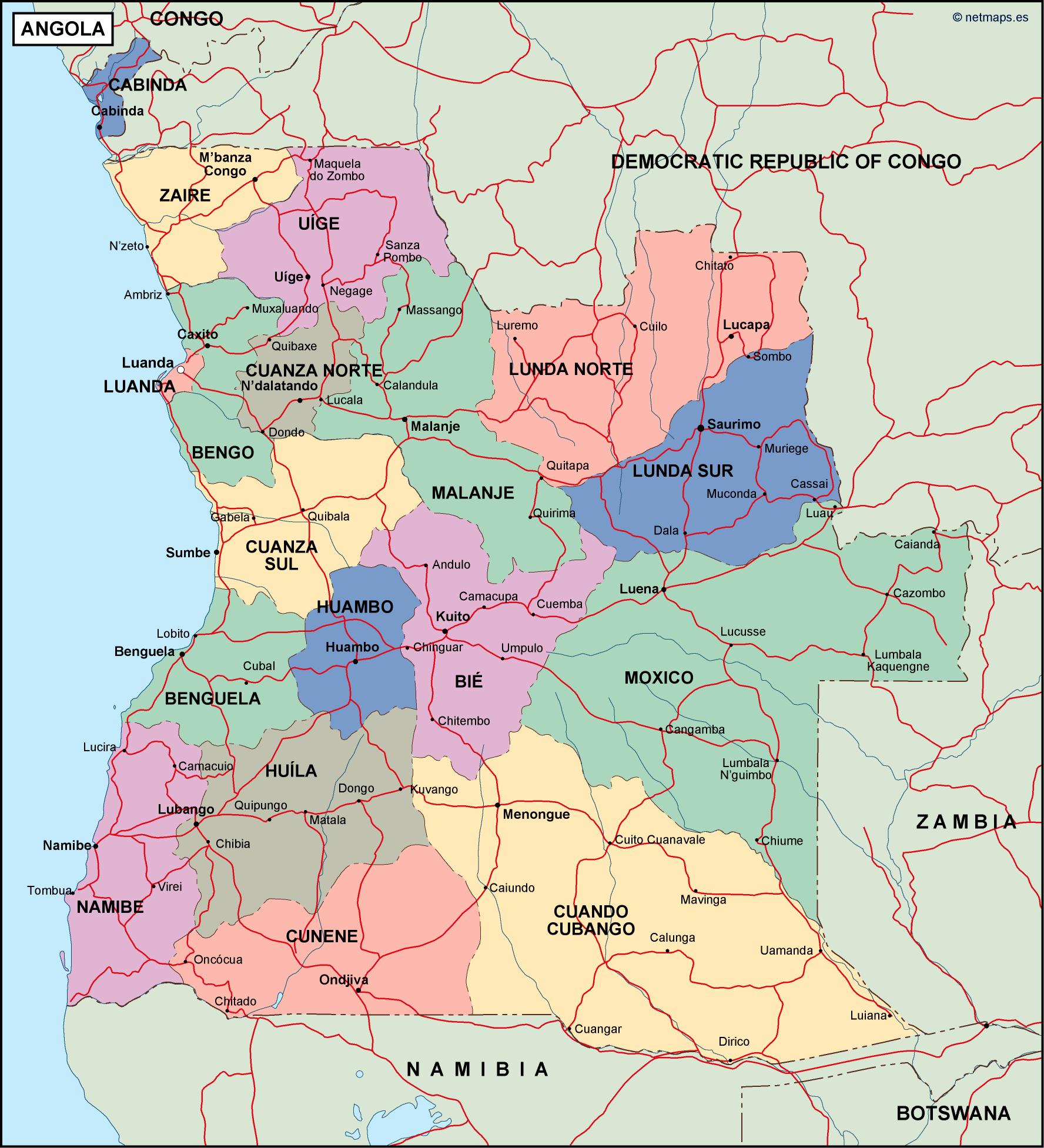
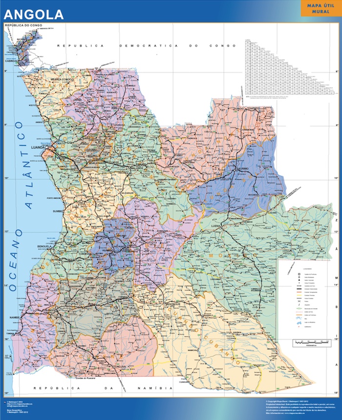
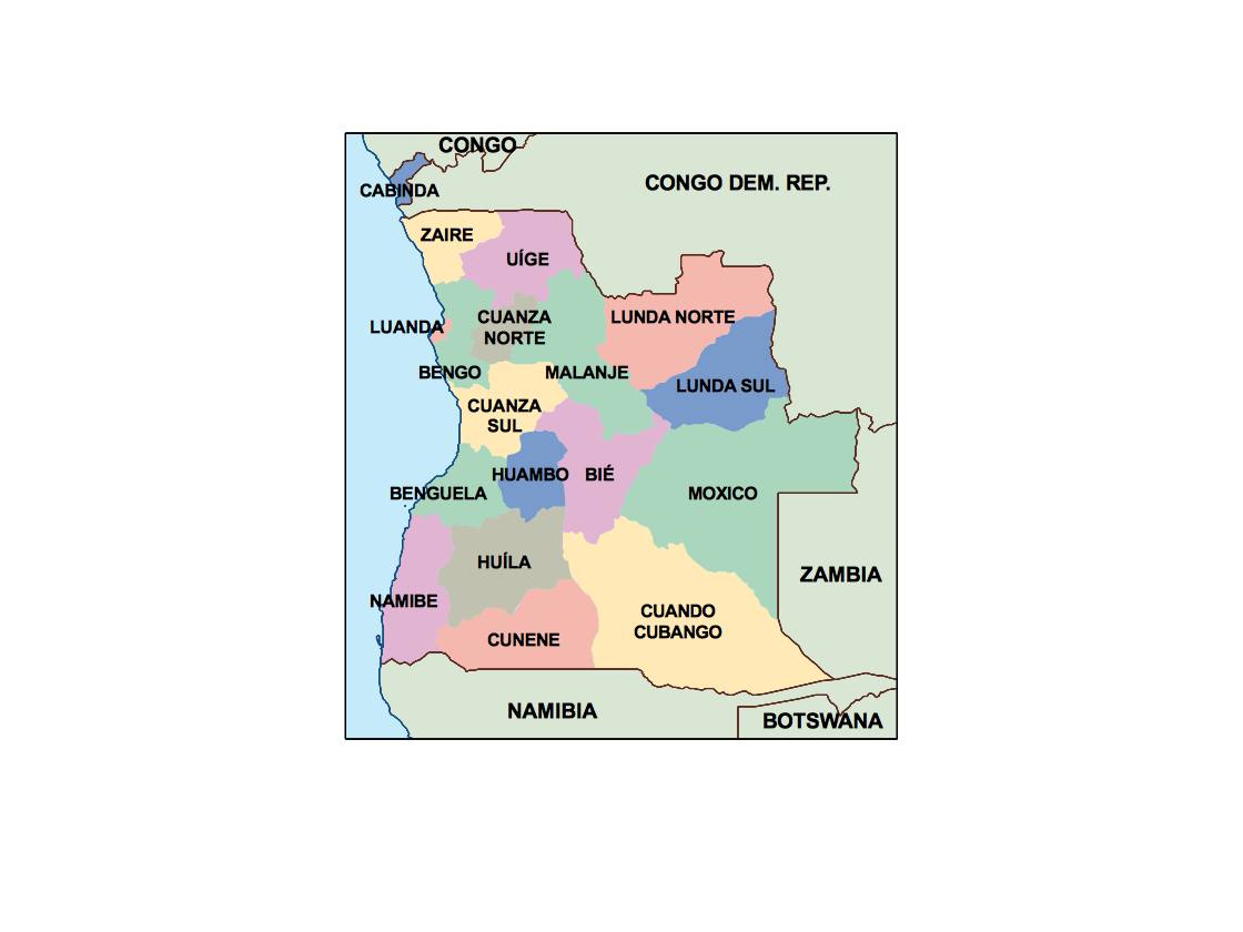
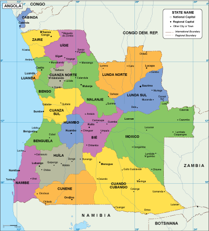
angola political map. Digital Maps Online. Adobe Illustrator .AI EPS Vector files from our Netmaps database. Vector maps from Africa. Illustrator EPS files, fully editable from our African map database. All our digital cartography was created with Vector Adobe Illustrator

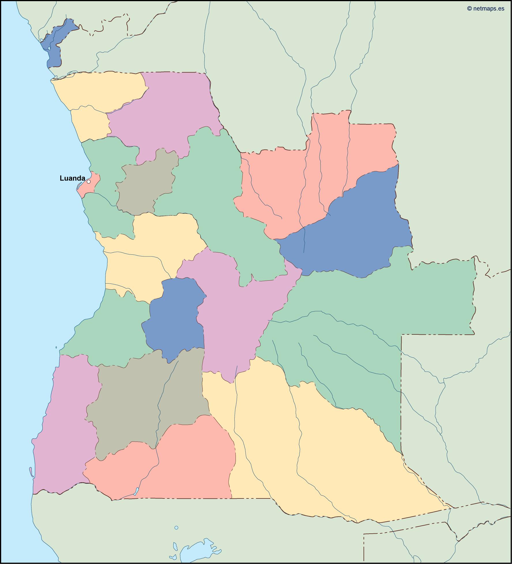
angola blind map. Digital Maps Online. Adobe Illustrator .AI EPS Vector files from our Netmaps database. Vector maps from Africa. Illustrator EPS files, fully editable from our African map database. All our digital cartography was created with Vector Adobe Illustrator
angola vector map. Digital Maps Online. Adobe Illustrator .AI EPS Vector files from our Netmaps database. Vector maps from Africa. Illustrator EPS files, fully editable from our African map database. All our digital cartography was created with Vector Adobe Illustrator