Taiwan Economic map

Taiwan Economic map

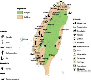
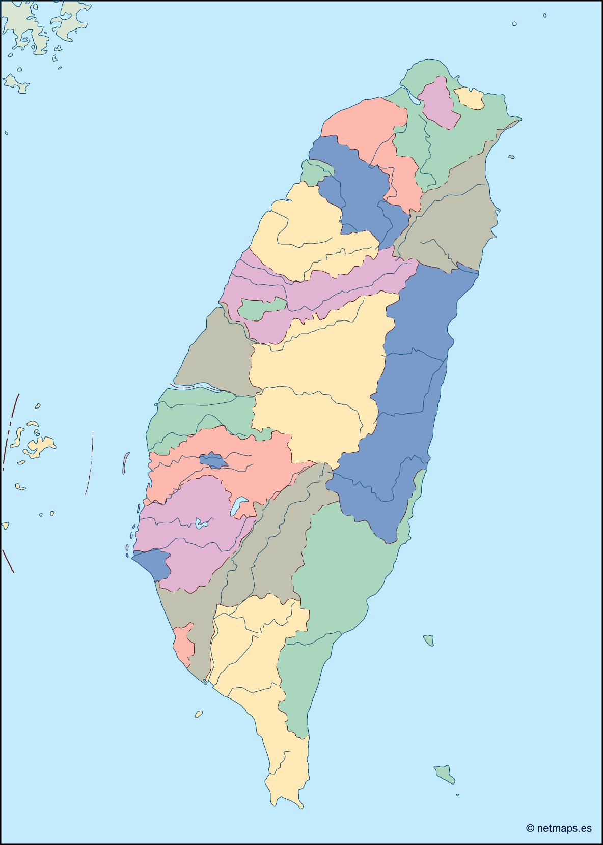
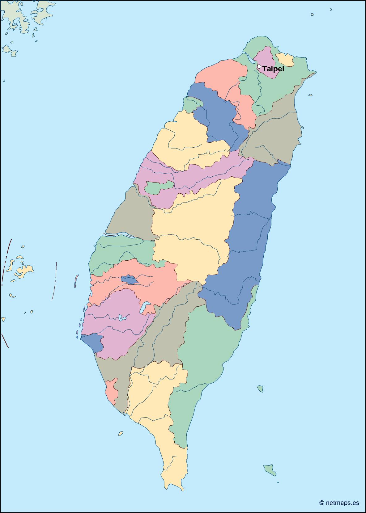
Taiwan Economic map. Economic map. Our vector eps illustrator map. Our vector map has the three basic symbol types for vector data as points, lines and polygons (areas).

Our team of cartographers use these symbols to represent real-world features in maps, they often have to decide based on the level of detail in the map. In a economic map our map illustrates various economic phenomena and activities in a country

taiwan presentation map

taiwan presentation map

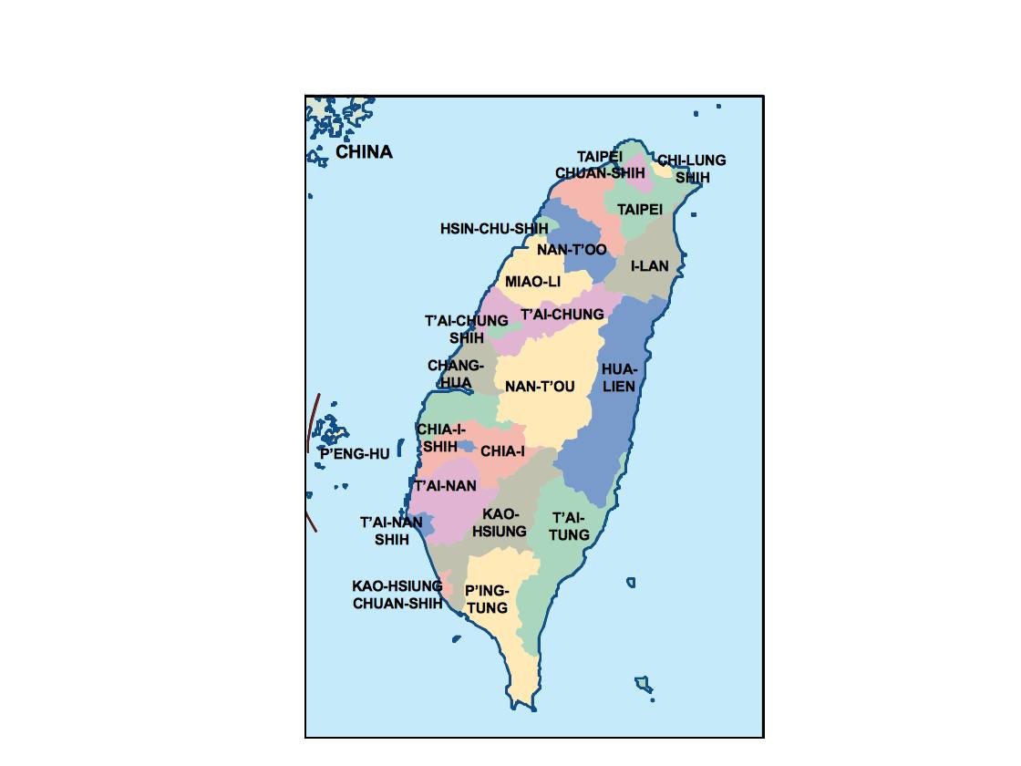
taiwan presentation map. Our map is part of our Netmaps’ Collection of PowerPoint Maps and Map outlines that you can use in your presentations.

Download editable maps for PowerPoint presentations with customizable maps that helps you prepare awesome presentations with sales by country or territory. Our editable PowerPoint maps are perfect for sales, marketing and supply chain presentations. We have country maps, continent maps and also World maps.

All PowerPoint slides are available in Microsoft’s .ppt format. This means that you should use MIcrosoft PowerPoint or OpenOffice. You can change the colours and lines to create interesting effects and designs. All slides come with a standardized colour scheme, effect and background design. If you wish to use your company’s corporate design, simply copy the slides into an existing company presentation and apply the design to the slide. That way slides could adopt your corporate design.

Creating thematic maps for Business or Marketing such as territory maps or sales maps is simply because all countries and maps are individual selectable shapes. Netmaps gives you the opportunity to create effortless dynamic custom maps for your presentations. They are professionally designed, perfectly optimized for business presentation requirements and ready to customize.

taiwan illustrator map

taiwan illustrator map

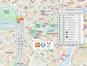
taiwan illustrator map. Digital Maps Online. Adobe Illustrator .AI EPS Vector files from our Netmaps database. Vector maps from Asia. Illustrator EPS files, fully editable from our Asian Country map database. All our digital cartography was created with Vector Adobe Illustrator

taiwan political map

taiwan political map

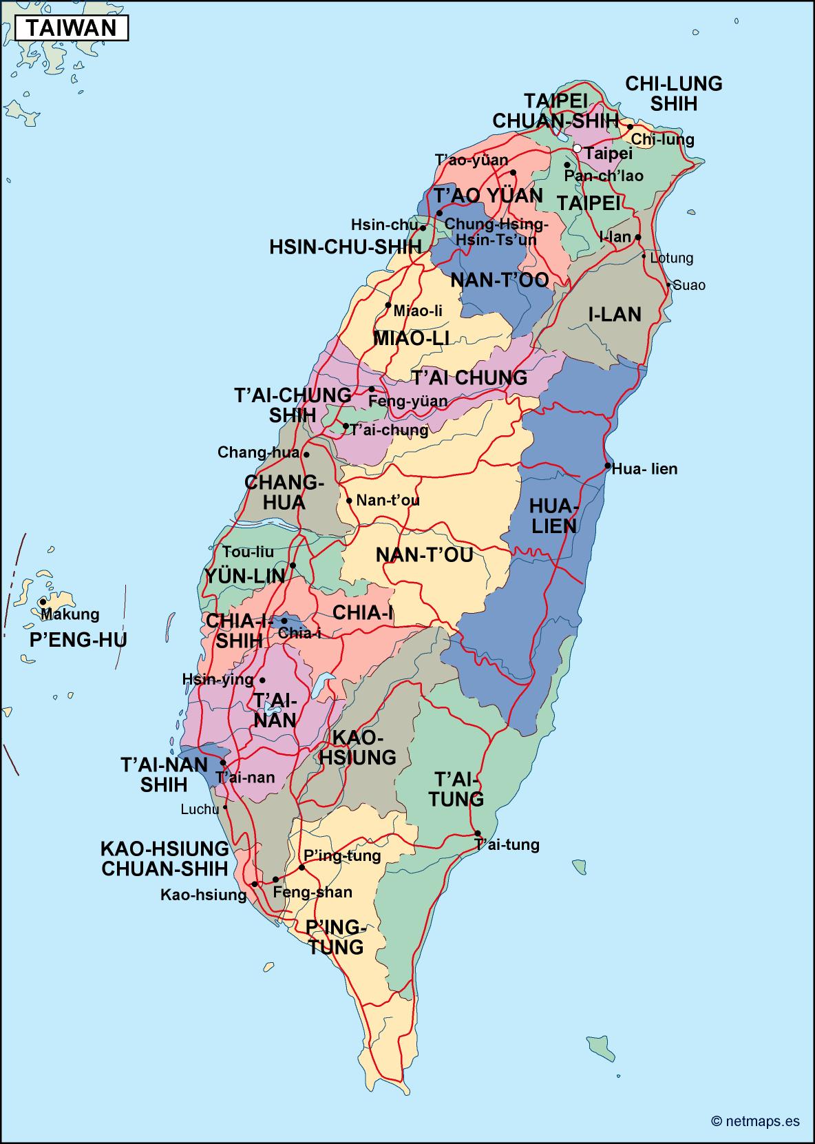
taiwan political map. Digital Maps Online. Adobe Illustrator .AI EPS Vector files from our Netmaps database. Vector maps from Asia. Illustrator EPS files, fully editable from our Asian Country map database. All our digital cartography was created with Vector Adobe Illustrator

taiwan blind map

taiwan blind map

taiwan blind map. Digital Maps Online. Adobe Illustrator .AI EPS Vector files from our Netmaps database. Vector maps from Asia. Illustrator EPS files, fully editable from our Asian Country map database. All our digital cartography was created with Vector Adobe Illustrator

taiwan vector map

taiwan vector map

taiwan vector map. Digital Maps Online. Adobe Illustrator .AI EPS Vector files from our Netmaps database. Vector maps from Asia. Illustrator EPS files, fully editable from our Asian Country map database. All our digital cartography was created with Vector Adobe Illustrator

Vector Eps Maps

Maps Store: Vector EPS Maps

All countries of the world as vector EPS Illustrator files

Vector eps maps

All our maps has been created via Adobe Illustrator or Macromedia freehand. Maps are templates ready to be edited with your design software.

City Illustrator Maps

Digital Vector City maps for your projects

vector maps

Download our vector files for any of our city maps, from streetmaps detailed to area maps. More than 10 000 cities availables of the world

Powerpoint Maps for Presentations

You need to improve any presentation with maps. Take our editable maps for Powerpoint or Open Office

powerpoint maps

Maps for your company

Bespoke maps. Promotional Projects, Atlases. Any project where you need a map just let us know. From country maps to ZIP postal codes maps from any country of the world.

Maps Company


Eps vector maps

Find your map!. More than 20.000 digital files online

Directory of vector maps of the world: Political, physical, thematic, landuse, vegetation, climate, population and others digital eps maps:


Africa Maps

Algeria, Angola, Benin, Botswana, Burkina Faso, Burundi, Cameroon, Cape Verde, Central Africa Republic, Comoros, Congo, Congo Democratic Republic, Chad, Djibouti, Egypt, Equatorial Guinea, Eritrea, Ethiopia, Gabon, Gambia, Ghana, Guinea, Guinea Bissau, Ivory Coast, Kenya, Lesotho, Liberia, Lybia, Madagascar, Malawi, Mali, Mauritania, Mauritius, Morocco, Mozambique, Namibia, Niger, Nigeria, Rwanda, Sao Tome e Principe, Senegal, Seychelles, Sierra Leone, Somalia, South Africa Republic, South Sudan, Sudan, Swaziland, Tanzania, Togo, Tunisia, Uganda, Zambia, Zimbabwe


Asia Maps

Afghanistan, Armenia, Azerbaijan, Bahrain, Bangladesh, Bhutan, Brunei, Burma, Cambodja, China, Cyprus, East Timor, Georgia, India, Indonesia, Iran, Iraq, Israel, Japan, Jordan, Kazajstan, Kirgizistan, Kuwait, Laos, Lebanon, Malaysia, Maldives, Mongolia, Nepal, North Korea, Oman, Pakistan, Philippines, Qatar, Russia, Saudi Arabia, Singapore, South Korea, Sri Lanka, Syria, Taiwan, Tajikistan, Thailand, Turkey, Turkmenistan, United Arab Emirates, Uzbekistan, Vietnam, Yemen


America Maps

Antigua, Argentina, Bahamas, Barbados, Belize, Bolivia, Brazil, Canada, Chile, Colombia, Costa Rica, Cuba, Dominica, Dominicana, Republic, Ecuador, El Salvador, Grenada, Guatemala, Guyana, Haiti, Honduras, Jamaica, Mexico, Nicaragua, Panama, Paraguay, Peru, Puerto Rico, St. Christopher Nevis, St. Lucia, St. Vincent & Grenadines, Surinam, Trinidad y Tobago, Uruguay, USA, Venezuela


Europe Maps

Albania , Austria , Andorra , Belarus , Belgium , Bosnia-Herzegovina , Bulgaria . City of Vatican , Croatia , Czech Republic , Denmark , Estonia , Finland , France , Germany , Greece , Hungary , Iceland , Ireland , Italy , Latvia , Liechtenstein , Lithuania , Luxembourg , Macedonia , Malta , Moldova , Monaco , Montenegro , Norway , Netherlands , Poland , Portugal , Romania , Russia , San Marino , Serbia , Slovak Republic , Slovenia , Spain , Sweden , Switzerland , Turkey , Ukraine , United Kingdom


Oceania Maps

Australia, Federated States of Micronesia, Fidji, Kiribati, Marshall, Nauru, New Zealand, Palau, Papua New Guinea, Solomon, Samoa, Tonga, Tuvalu, Vanuatu


Wall Maps: Vinyl Maps, from 89,00 euros
Custom maps available. Worldwide delivery included
From World Maps to Country and City maps of the world
vinyl maps

Laminated Wall Maps, 79,50 euros. Maps are Write on / Wipe off. Velleda ©Bic. Worldwide delivery includedlaminated mapsMagnetic Framed Maps, 449,50 euros. Maps on a metallic board, ready for magnets. Worldwide delivery included magnetic maps

Asia Vector Maps

Asia is one of the five continents of the world. More than 1000 vector maps of Asia online to be downloaded from any country.

Vector maps of countries of Asia

available in Adobe Illustrator, EPS, PDF, PNG and JPG formats to download. Our collection is designed to easily create your own map projects for personal or commercial use without any restriction, for graphic designers, journalists, students and people who need to create maps easily and quickly.

Afghanistan
Armenia
Azerbaijan
Bahrain

Bangladesh
Bhutan
Brunei
Burma

Cambodja
China
Cyprus
East Timor

Georgia
India
Indonesia
Iran

Iraq
Israel
Japan
Jordan

Kazajstan
Kirgizistan
Kuwait
Laos

Lebanon
Malaysia
Maldives
Mongolia

Nepal
North Korea
Oman
Pakistan

Philippines
Qatar
Russia
Saudi Arabia

Singapore
South Korea
Sri Lanka
Syria

Taiwan
Tajijistan
Thailand
Turkey

Turkmenistan
United Arab Emirates
Uzbekistan
Vietnam
Yemen

Vector maps

Vector maps from netmaps we take pride in offering a comprehensive collection of high-quality vector maps, meticulously crafted to meet your diverse needs. Whether you’re a designer, educator, business professional, or an enthusiast exploring the world through maps, we have the perfect solution for you

Vector maps

Our maps are digital data of maps that is consisted of X-Y coordinates. When our team draw lines and polygons with these coordinates, we can create maps. A vector map is basically a database of points, lines and polygons which collectively make up all the features on the map. It’s possible to assign each of these features extra informationIllustrator maps

Adobe Illustrator for maps

Our vector maps are created mainly via digital software. To edit the maps, you will need a vector editing program such as Adobe Illustrator® or Macromedia Freehand®

Africa Vector EPS Illustrator Country Maps:

Algeria, Angola, Benin, Botswana, Burkina Faso, Burundi, Cameroon, Cape Verde, Central Africa Republic, Comoros, Congo , Congo Democratic Republic, Chad, Djibouti, Egypt, Equatorial Guinea, Eritrea, Ethiopia, Gabon, Gambia, Ghana, Guinea, Guinea Bissau, Ivory Coast, Kenya, Lesotho, Liberia, Libya, Madagascar, Malawi, Mali, Mauritania, Mauritius, Morocco, Mozambique, Namibia, Niger, Nigeria, Rwanda, Sao Tome e Principe, Senegal, Seychelles, Sierra Leone, Somalia, South Africa Republic, South Sudan, Sudan, Swaziland, Tanzania, Togo, Tunisia, Uganda, Zambia, Zimbabwe

America Vector EPS Illustrator Country Maps:

Antigua, Argentina, Bahamas, Barbados, Belize, Bolivia, Brazil, Canada, Chile, Colombia, Costa Rica, Cuba, Dominica, Dominicana Republic, Ecuador, El Salvador, Grenada, Guatemala, Guyana, Haiti, Honduras, Jamaica, Mexico, Nicaragua, Panama, Paraguay, Peru, Puerto Rico, St. Christopher Nevis, St. Lucia, St. Vincent & Grenadines, Surinam, Trinidad y Tobago, Uruguay, USA, Venezuela

Asia Vector EPS Illustrator Country Maps:

Afghanistan, Armenia, Azerbaijan, Bahrain, Bangladesh, Bhutan, Brunei, Burma, Cambodja, China, Cyprus, East Timor, Georgia, India, Indonesia, Iran, Iraq, Israel, Japan, Jordan, Kazajstan, Kirgizistan, Kuwait, Laos, Lebanon, Malaysia, Maldives, Mongolia, Nepal, North Korea, Oman, Pakistan, Philippines, Qatar, Russia, Saudi Arabia, Singapore, South Korea, Sri Lanka, Syria, Taiwan, Tayijistan, Thailand, Turkey, Turkmenistan, United Arab Emirates, Uzbekistan, Vietnam, Yemen

Europe Vector EPS Illustrator Country Maps:

Albania, Austria, Andorra, Belarus, Belgium, Bosnia-Herzegovina, Bulgaria, City of Vatican, Croatia, Czech Republic, Denmark, Estonia, Finland, France, Germany, Greece, Hungary, Iceland, Ireland, Italy, Latvia, Liechtenstein, Lithuania, Luxembourg, Macedonia, Malta, Moldova, Monaco, Montenegro, Norway, Netherlands, Poland, Portugal, Romania, Russia, San Marino, Serbia, Slovak Republic, Slovenia, Spain, Sweden, Switzerland, Turkey, Ukraine, United Kingdom

Oceania Vector EPS Illustrator Country Maps:

Australia, Federated States of Micronesia, Fidji, Kiribati, Marshall, Nauru, New Zealand, Palau, Papua New Guinea, Solomon, Samoa, Tonga, Tuvalu, Vanuatu


Vector EPS City Maps:

America Vector EPS City Maps

Canada City Vector Maps
USA City Vector Maps
Brazil City Vector Maps

Asia Vector EPS City Maps

Emirates City Vector Maps
India City Vector Maps

Europe Vector EPS City Maps

Belgium City Vector Maps
Denmark City Vector Maps
France City Vector Maps
Germany City Vector Maps
Ireland City Vector Maps
Italy City Vector Maps
Norway City Vector Maps
Poland City Vector Maps
Spain City Vector Maps
Sweden City Vector Maps
Ukraine City Vector Maps
United Kingdom City Vector Maps

Oceania Vector EPS City Maps

Australia City Vector Maps


Vector EPS City Maps

Other City Vector Maps ordered by price